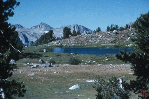
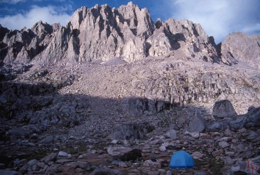
 Twin Lakes. One of several dozen Twin Lakes in the Sierra. You could
spend a year on a Twin Lakes loop. This one is at the junction of the
Muir Trail and the Sawmill Pass Trail.
Twin Lakes. One of several dozen Twin Lakes in the Sierra. You could
spend a year on a Twin Lakes loop. This one is at the junction of the
Muir Trail and the Sawmill Pass Trail.
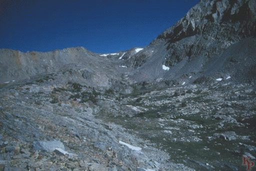
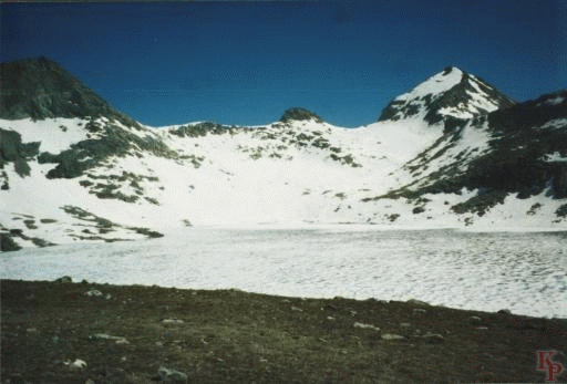 Martha Lake (upper Goddard Canyon) (11,000ft), August.
Still frozen. Need I say more.
It is a long trip to the lake, but is one of the
better locations. This is located the north eastern part of the park
(out of the Kings River drainage, near
Evolution Basin).
One access is the long slow climb from Florence Lake or cross country
from Evolution Basin.
But the best access is via Hell for Sure Pass (11297ft), like many names of
features in the Sierra, there is a reason. (Remember best access is a
comparative term not an absolute judgement.)
Martha Lake (upper Goddard Canyon) (11,000ft), August.
Still frozen. Need I say more.
It is a long trip to the lake, but is one of the
better locations. This is located the north eastern part of the park
(out of the Kings River drainage, near
Evolution Basin).
One access is the long slow climb from Florence Lake or cross country
from Evolution Basin.
But the best access is via Hell for Sure Pass (11297ft), like many names of
features in the Sierra, there is a reason. (Remember best access is a
comparative term not an absolute judgement.)

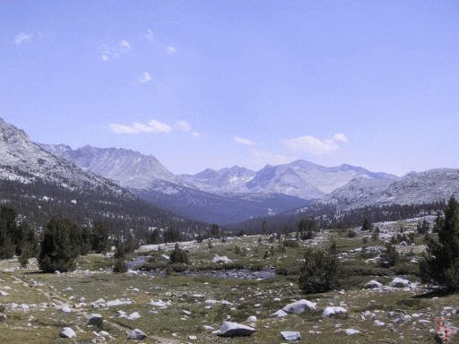
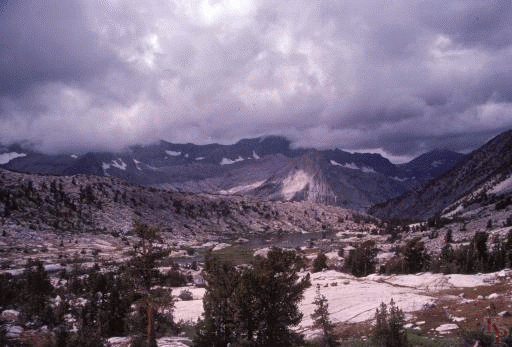 Dusy Basin (11,300ft), a good day's hike in from the
South Lake road end (9700ft) over Bishop Pass (11,972ft).
The ideal stopping point to
prepare for the drop that leads to the Muir Trail at
Little Pete Meadow (8720ft)
and the climb to
Muir Pass (11,955ft). Part of the popular 5-7 day North Lake/South Lake hike
through Evolution Basin.
This area also provides access to the less travelled Palisades Basin.
Dusy Basin (11,300ft), a good day's hike in from the
South Lake road end (9700ft) over Bishop Pass (11,972ft).
The ideal stopping point to
prepare for the drop that leads to the Muir Trail at
Little Pete Meadow (8720ft)
and the climb to
Muir Pass (11,955ft). Part of the popular 5-7 day North Lake/South Lake hike
through Evolution Basin.
This area also provides access to the less travelled Palisades Basin.
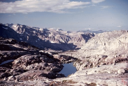 Knapsack Pass (this route was a horse trail when stock
grazing was allowed in the Palisades Basin).
The pass provides the access from Dusy Basin to
Palisades Basin.
Knapsack Pass (this route was a horse trail when stock
grazing was allowed in the Palisades Basin).
The pass provides the access from Dusy Basin to
Palisades Basin.
 Palisade Basin -- This is the back side of the Palisades. They are visible from
the Big Pine area. (And are over 14,000) North Palisade (14242ft) is above
this basin, Middle Palisade (14040ft) and Split Mountain (14058ft)
(maybe it should be South Palisade, but the notch at the top
gives it the Split Mountain name) are to the south.
Palisade Basin -- This is the back side of the Palisades. They are visible from
the Big Pine area. (And are over 14,000) North Palisade (14242ft) is above
this basin, Middle Palisade (14040ft) and Split Mountain (14058ft)
(maybe it should be South Palisade, but the notch at the top
gives it the Split Mountain name) are to the south.
 Pinchot Pass (12050ft). This region between Sawmill (11347ft) and
Taboose (11400ft) Passes to the east
is some of the best high country along the Muir Trail.
This is one of the strenuous hikes due to the
distance to any road. Taboose Pass is the shortest access, but it is one
of the famous exteme passes on the east side.
Pinchot was the "father" of the
forest service, he tended more toward use (as in the
Forest Service Multiple Use) than preservation (as was the case for Mather,
the "father" of the park service).
Pinchot Pass (12050ft). This region between Sawmill (11347ft) and
Taboose (11400ft) Passes to the east
is some of the best high country along the Muir Trail.
This is one of the strenuous hikes due to the
distance to any road. Taboose Pass is the shortest access, but it is one
of the famous exteme passes on the east side.
Pinchot was the "father" of the
forest service, he tended more toward use (as in the
Forest Service Multiple Use) than preservation (as was the case for Mather,
the "father" of the park service).
 Taboose Pass trail. The view is to Bench Lake. This area between Mather and
Pinchot is worth a trip. The road ends (and the trail starts)
at 5300ft with Taboose Pass a 7 mile hike to the 11,400ft crest.
Mather (the "father" of the Park Service favored preservation)
and Pinchot had different views on parks and preservation
but their passes are consecutive along the Muir Trail.
Taboose Pass trail. The view is to Bench Lake. This area between Mather and
Pinchot is worth a trip. The road ends (and the trail starts)
at 5300ft with Taboose Pass a 7 mile hike to the 11,400ft crest.
Mather (the "father" of the Park Service favored preservation)
and Pinchot had different views on parks and preservation
but their passes are consecutive along the Muir Trail.
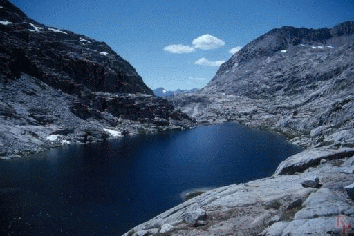 Palisades Lake (10,650ft) -- on the Muir Trial -- is below the
Palisades Basin region (did
you expect Palisades Lake to be in the Palisades Basin?).
Located below Mather Pass (12080ft) and above the Golden Staircase this
becomes
the obvious place to stop going in either direction.
Palisades Lake (10,650ft) -- on the Muir Trial -- is below the
Palisades Basin region (did
you expect Palisades Lake to be in the Palisades Basin?).
Located below Mather Pass (12080ft) and above the Golden Staircase this
becomes
the obvious place to stop going in either direction.
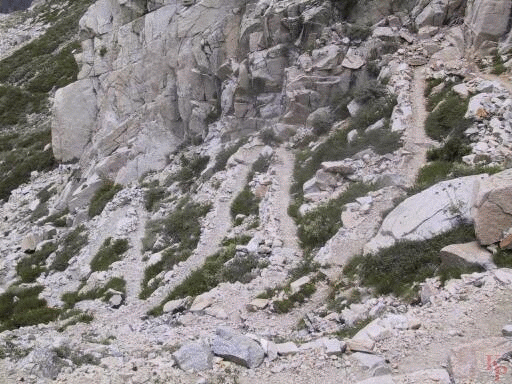 The Golden Staircase. It passes through some yellow (golden) strata (not
so apparent in this picture), it is essentially a staircase. Enough said.
The Golden Staircase. It passes through some yellow (golden) strata (not
so apparent in this picture), it is essentially a staircase. Enough said.
 Between Muir Pass (11,955ft) to the north and Mather Pass (12,100ft)
to the south
and below the Golden staircase you pass through the
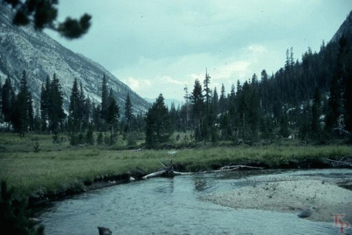
Little Pete Meadow (in Le Conte Canyon 8729ft). A nice meadow,
but with a lot of traffic for something so remote. The main access is
from South Lake (9700ft) over Bishop Pass (11,972ft)
which meets the Muir Trail here.
Everyone else is on a longer trip or on a pack (mule) trip.
Between Muir Pass (11,955ft) to the north and Mather Pass (12,100ft)
to the south
and below the Golden staircase you pass through the
Little Pete Meadow (in Le Conte Canyon 8729ft). A nice meadow,
but with a lot of traffic for something so remote. The main access is
from South Lake (9700ft) over Bishop Pass (11,972ft)
which meets the Muir Trail here.
Everyone else is on a longer trip or on a pack (mule) trip.
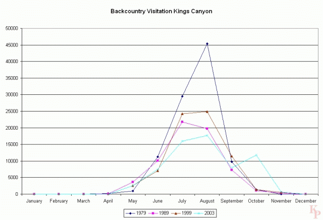
Backcountry visitation depends on the weather. Few people visit through the winter. Visitation declined substantially in the 1980's due to many factors. Some was caused by the application of a trail head quota system that limits damage to popular areas and encourages people to try less used trails or times other than weekends. In some cases over used lakes were made off limits for camping and the grazing of livestock (pack mules and horses) was restricted. Today you see the improved conditions as some of these meadows are looking better. Why is October 2003 so high? It is also high for Sequoia.
 Return to my Sequoia Kings Canyon home page.