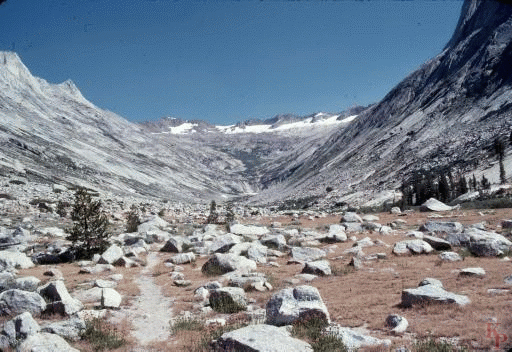
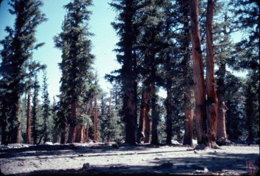
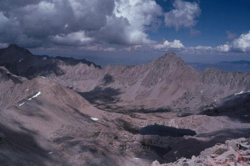
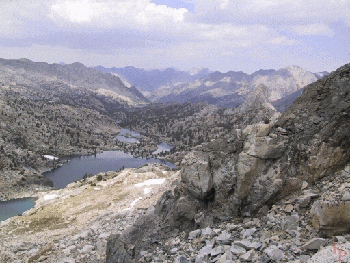
 Upper Ranger Meadow. Once you get up and out of
Bubbs Creek you eventually get to high country with the open views, tundra,
and flowers. For a stereo view, see
Upper Ranger
Meadow Stereo.
Upper Ranger Meadow. Once you get up and out of
Bubbs Creek you eventually get to high country with the open views, tundra,
and flowers. For a stereo view, see
Upper Ranger
Meadow Stereo.
|
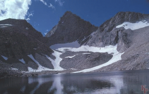
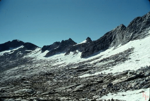 Elizabeth Pass (11400ft) is on the
Kings Canyon and Sequoia
border above the High Sierra Trail.
This is a typical glaciated cirque with mid summer snow. One of the
interesting car shuttle trips -- Roads End to Crescent Meadow.
Elizabeth Pass (11400ft) is on the
Kings Canyon and Sequoia
border above the High Sierra Trail.
This is a typical glaciated cirque with mid summer snow. One of the
interesting car shuttle trips -- Roads End to Crescent Meadow.
|
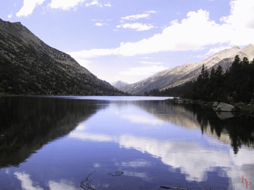
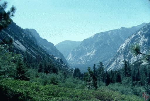 Bubbs Creek joins the Kings at Cedar Grove, which is
also called Roads End. The river junction is just one more
long drop down the trail from here.
Bubbs Creek joins the Kings at Cedar Grove, which is
also called Roads End. The river junction is just one more
long drop down the trail from here.
|
 Mist Falls is up the other branch. This trail goes
to the Woods Creek crossing (another bridge that was washed out in the
wet early 1980s and replaced by something more exciting) and eventually
to Rae Lakes and back down Bubbs Creek.
Mist Falls is up the other branch. This trail goes
to the Woods Creek crossing (another bridge that was washed out in the
wet early 1980s and replaced by something more exciting) and eventually
to Rae Lakes and back down Bubbs Creek.
|
 Junction Meadow has a major trail junction (at least the name still
applies, unlike names of suburban locations). The river crossing
is easiest at the meadow so it is hard to reroute the trail completely onto
the rockier slopes. One direction is the PCT/Muir trail south toward Forrester
Pass (13160ft), the second is the PCT/Muir trail north to Glen Pass (11978ft),
the third is down to Cedar Grove.
Junction Meadow has a major trail junction (at least the name still
applies, unlike names of suburban locations). The river crossing
is easiest at the meadow so it is hard to reroute the trail completely onto
the rockier slopes. One direction is the PCT/Muir trail south toward Forrester
Pass (13160ft), the second is the PCT/Muir trail north to Glen Pass (11978ft),
the third is down to Cedar Grove.
|
 Some passes are obvious, others aren't noticeable without
a sign, as in the case of Avalanche Pass (10040ft). It is located
south of Bubbs Creek on the route to Ranger Meadow (7400ft)
and Elizabeth Pass (11400ft).
Some passes are obvious, others aren't noticeable without
a sign, as in the case of Avalanche Pass (10040ft). It is located
south of Bubbs Creek on the route to Ranger Meadow (7400ft)
and Elizabeth Pass (11400ft).
|
 Charlotte Lake (10370ft). The back country ranger cabin is located here,
the scenery is the primary draw
for summer rangers -- it certainly is not the pay. The lake is
below the Muir Trail, but there is little other camping between Bubbs Creek
and Rae Lakes. How little depends on the size of your group since you can
usually find legal sites for 2 people near any stream crossing.
Charlotte Lake (10370ft). The back country ranger cabin is located here,
the scenery is the primary draw
for summer rangers -- it certainly is not the pay. The lake is
below the Muir Trail, but there is little other camping between Bubbs Creek
and Rae Lakes. How little depends on the size of your group since you can
usually find legal sites for 2 people near any stream crossing.
|
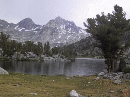 Rae Lakes (10696ft), July. This area is heavily used,
say hello to the ranger (though it is close to Charlotte Lake, it is a
different ranger -- the patrol area is roughly from pass to pass), he has
been there for a number of summers.
It is part of a popular loop up from Cedar Grove, and has access to the east
via the easy Kearsarge Pass (11823ft) above Onion Valley (9100ft).
The Muir Trail traffic just adds a bit to the crowds.
The Baxter Pass trail, which
connects in the lake area leads directly to the
Owens Valley, is another story.
Rae Lakes (10696ft), July. This area is heavily used,
say hello to the ranger (though it is close to Charlotte Lake, it is a
different ranger -- the patrol area is roughly from pass to pass), he has
been there for a number of summers.
It is part of a popular loop up from Cedar Grove, and has access to the east
via the easy Kearsarge Pass (11823ft) above Onion Valley (9100ft).
The Muir Trail traffic just adds a bit to the crowds.
The Baxter Pass trail, which
connects in the lake area leads directly to the
Owens Valley, is another story.
|
 Rae Lakes. Even though there is more snow, it is August.
|
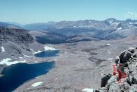
 Center Basin is rarely visited. At one time it was on the
Muir Trail Route (via Junction (13200ft) and Shepard (12050ft) Passes),
until the route
over Forrester Pass (13160ft) was completed. Today, Shepard Pass is
lightly used
(the length of the climb from the road has a lot to do with that)
and is difficult
to maintain (the crossing of the snow bowl near the top
can make for an exciting 90 seconds).
Center Basin is rarely visited. At one time it was on the
Muir Trail Route (via Junction (13200ft) and Shepard (12050ft) Passes),
until the route
over Forrester Pass (13160ft) was completed. Today, Shepard Pass is
lightly used
(the length of the climb from the road has a lot to do with that)
and is difficult
to maintain (the crossing of the snow bowl near the top
can make for an exciting 90 seconds).
|
 The Forrester Pass (13160ft) approach is long and strenous, but
leads to the highest pass on the PCT (the Muir Trail
ends on the top of Mt. Whitney, which is higher).
It is lower than Junction Pass
(at the head of Center Basin a bit east of Forrester),
but was more difficult to construct.
The north side is the typical cirque with a series of switch backs across
the scree and almost always some snow to cross, but the slope is not
extreme.
The Forrester Pass (13160ft) approach is long and strenous, but
leads to the highest pass on the PCT (the Muir Trail
ends on the top of Mt. Whitney, which is higher).
It is lower than Junction Pass
(at the head of Center Basin a bit east of Forrester),
but was more difficult to construct.
The north side is the typical cirque with a series of switch backs across
the scree and almost always some snow to cross, but the slope is not
extreme. |
 The south side is a cliff. The trail required dynamite. Be sure to
make the turn at the top.
The south side is a cliff. The trail required dynamite. Be sure to
make the turn at the top.
|
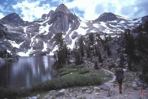
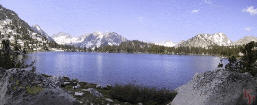 Bullfrog Lake. Closed to camping. In the 1960s this lake was overrun and
there isn't much space that makes sense for camping anyway. The
Muir Trail is about a mile away so there is a lot of potential
traffic. Now you continue to Charlotte which is better suited to
camping (but off the main trail). The current trail to Kearsarge Pass
is well above Bullfrog, but the side trail from Kearsarge Lakes
comes directly to Bullfrog on the way to the Muir Trail.
Bullfrog Lake. Closed to camping. In the 1960s this lake was overrun and
there isn't much space that makes sense for camping anyway. The
Muir Trail is about a mile away so there is a lot of potential
traffic. Now you continue to Charlotte which is better suited to
camping (but off the main trail). The current trail to Kearsarge Pass
is well above Bullfrog, but the side trail from Kearsarge Lakes
comes directly to Bullfrog on the way to the Muir Trail.
|
 Sixty Lake basin is a detour off the Rae Lakes area and a part of
a popular one
week loop from Kearsarge Pass (11823ft) (and Onion Valley). You can count 60
lakes if you allow small lakes, but you can get more than 60 if you
take the ponds and count early in the summer. Being a detour, there
are fewer people (the more used trail hits a dead end, but there is a
route out the north back to the Muir Trail).
Sixty Lake basin is a detour off the Rae Lakes area and a part of
a popular one
week loop from Kearsarge Pass (11823ft) (and Onion Valley). You can count 60
lakes if you allow small lakes, but you can get more than 60 if you
take the ponds and count early in the summer. Being a detour, there
are fewer people (the more used trail hits a dead end, but there is a
route out the north back to the Muir Trail).
|
 Return to my Sequoia Kings Canyon home page.