Most of Sequoia is managed as Wilderness (essentially everything more than 1 mile from a road -- wilderness is best defined by what the Wilderness Act of 1964 says, and by various designations, not by anything else). Overall, in these 2 parks 93.43% is officially designated and 3.5% more is managed as wilderness. The Sequoia park site has added an extended description of the wilderness with trip planning information and rules. Important information includes camping/grazing/fire restrictions, guides on food storage (use the approved portable container or camp near a storage locker), and rules on invasive plants and animals (snails primarily).
Wilderness is accessible by foot (either your feet or an animal's feet). It is also where you see fewer people. We have spent several consecutive days on major trails (i.e. the Muir Trail), and encountered less than 5 people. You have to walk to see it. Horses are allowed on most of the trails -- like everything this is both good and bad (it means trails need to be well constructed with limits on their steepness, but also that trails can be worn and dusty). In many areas, the routes taken by horse (mule) groups are obvious, just from the condition of the trail.
Much of the backcountry is dominated by the North-South Kern Trench with plateaus (and peaks, including Mt. Whitney) on either side. Access is either from the park roads (Mineral King (7830ft), Crescent Meadow (6700ft), or from the road in Kings Canyon). The Inyo National Forest access via the Mt. Whitney trail (14494ft, trail crest 13777ft) with difficult quotas due to the Whitney traffic, or Shepard Pass (12050ft) -- neither of these trails are easy -- leads to the Kern Trench area. There is also a trail from the south along the Kern River, which is best in the early season. The pictures from Kern River, Moraine Lake, Kern Hot Springs, Lake South America, Tyndall Creek, Bighorn Plateau, Tyndall Creek, Mount Whitney, have been separated out to reduce page lengths. Also, The Kings Canyon Backcountry is covered separately.
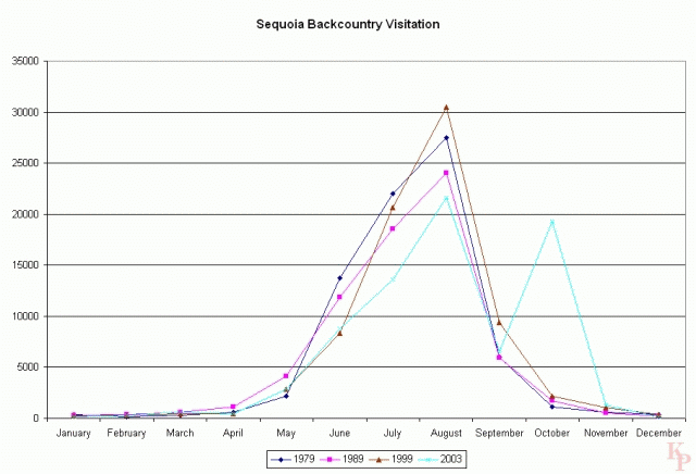
Backcountry visitation depends on the weather. Few people visit through the winter. Visitation declined a bit through the 1980's, but much less than in Kings Canyon, even with essentially the same quota system in both parks. Why is October 2003 so high? It is also high for Kings Canyon. Many people who hike the Sequoia backcountry enter from another wilderness area (especially the John Muir Wilderness) rather than directly from the Sequoia road. This may account for a large drop in 2004-2006 (not charted) if these people are not included in the totals (except for the Whitney region access, you did not have any special indication that you were going into the park). Also, Mt. Whitney (on the Sierra crest, thus the peak is on the park boundary) contributes to the numbers for Sequoia (and the continuing popularity of that hike keeps the Sequoia totals more stable). The Whitney trail has one of the highest daily quotas. |
|||
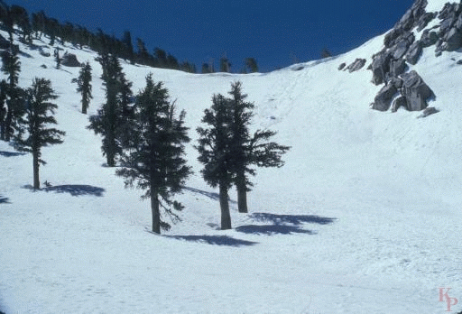 Coyote Pass (10160ft) is located at the far southern end of the park. It is a
route from the Kern Trench to the Little Kern Drainage.
You can, at the right time of the year (not the June in this picture),
use this trail
for an easy loop through the southern end of the park.
Coyote Pass (10160ft) is located at the far southern end of the park. It is a
route from the Kern Trench to the Little Kern Drainage.
You can, at the right time of the year (not the June in this picture),
use this trail
for an easy loop through the southern end of the park. |
|||
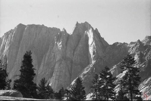
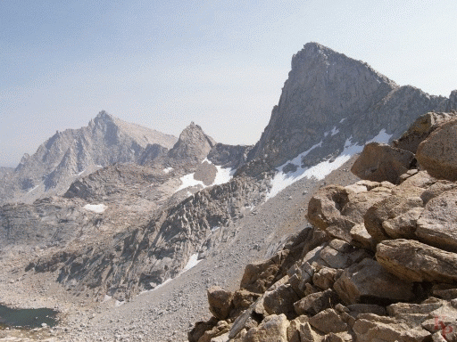 Sawtooth Peak (as viewed from Sawtooth Pass (11700ft))
is a distinctive feature above Mineral King.
The trail over the pass
eventually leads down to the lower Kern River. You can look for the Sawtooth
on the Alta Peak (11204ft) hike from the Lodgepole area.
From the pass you also have view to Columbine Lake.
Sawtooth Peak (as viewed from Sawtooth Pass (11700ft))
is a distinctive feature above Mineral King.
The trail over the pass
eventually leads down to the lower Kern River. You can look for the Sawtooth
on the Alta Peak (11204ft) hike from the Lodgepole area.
From the pass you also have view to Columbine Lake.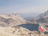
|
|||
 Franklin Creek in the Mineral King valley. This is another
route up and out of Mineral King (all routes are UP in Mineral King).
The standard trip is the loop back to Sawtooth Pass.
Franklin Creek in the Mineral King valley. This is another
route up and out of Mineral King (all routes are UP in Mineral King).
The standard trip is the loop back to Sawtooth Pass.
|
|||
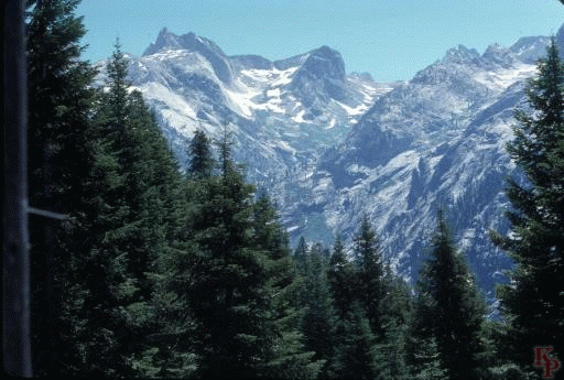
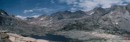
 From Alta Peak (11204ft) looking to the East, the Sierra Crest is mostly
behind the Kaweah-Kern divide. Alta is a standard, if long, day hike from
the Wolverton parking area. You meet a few people and see some animals.
The bear tracks followed the
trail until the cutoff to Bearpaw Meadow (7800ft).
Where else would a bear be headed?
From Alta Peak (11204ft) looking to the East, the Sierra Crest is mostly
behind the Kaweah-Kern divide. Alta is a standard, if long, day hike from
the Wolverton parking area. You meet a few people and see some animals.
The bear tracks followed the
trail until the cutoff to Bearpaw Meadow (7800ft).
Where else would a bear be headed?
|
|||
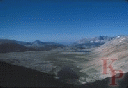
 Early on the High Sierra Trail (Crescent Meadow to Mt. Whitney, via Bearpaw
Meadow)
you start with the views
of the Hamilton Lakes area and the Kaweah headwaters. If you are headed to
the end of the trail (i.e. Whitney), this is just a hint of what is to come
and is a view of your next full day of hiking.
Early on the High Sierra Trail (Crescent Meadow to Mt. Whitney, via Bearpaw
Meadow)
you start with the views
of the Hamilton Lakes area and the Kaweah headwaters. If you are headed to
the end of the trail (i.e. Whitney), this is just a hint of what is to come
and is a view of your next full day of hiking.
|
|||
 At Bearpaw Meadow (7800ft)you can pay (and it is not cheap)
for
tent cabins, clean sheets, cooked meals, showers,
or keep hiking. If you want to pay, reserve early.
This is the somewhat more expensive Sequoia version of the
Yosemite High Sierra Camps.
Remember the name of the location and the bear tracks on the Alta Peak trail
when you decide on how you protect your food.
At Bearpaw Meadow (7800ft)you can pay (and it is not cheap)
for
tent cabins, clean sheets, cooked meals, showers,
or keep hiking. If you want to pay, reserve early.
This is the somewhat more expensive Sequoia version of the
Yosemite High Sierra Camps.
Remember the name of the location and the bear tracks on the Alta Peak trail
when you decide on how you protect your food.
|
|||
 Hamilton Lakes (8235ft) are a popular (and often over used)
location on the High Sierra Trail and a destination
for easy hikes into the backcountry. After Hamilton Lake (the larger
one), you
have Kaweah Gap (10700ft), the long descent into the Kern,
then the seemingly longer climb out with Whitney at the end.
The cliffs are appropriately named Vahallah.
Hamilton Lakes (8235ft) are a popular (and often over used)
location on the High Sierra Trail and a destination
for easy hikes into the backcountry. After Hamilton Lake (the larger
one), you
have Kaweah Gap (10700ft), the long descent into the Kern,
then the seemingly longer climb out with Whitney at the end.
The cliffs are appropriately named Vahallah.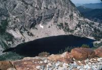
|
|||
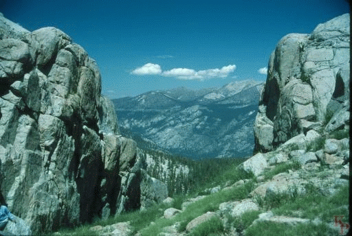
 Kaweah Gap (10700ft) leads to the
Nine Lakes Basin. Kaweah Gap is a pass
that looks like a pass should -- a route through a narrow cut.
Once you are over the pass, you see many fewer people. Indeed above
Hamilton Lake you see fewer people. Going through the pass begins your descent
into the Kern River Trench (6700ft).
Kaweah Gap (10700ft) leads to the
Nine Lakes Basin. Kaweah Gap is a pass
that looks like a pass should -- a route through a narrow cut.
Once you are over the pass, you see many fewer people. Indeed above
Hamilton Lake you see fewer people. Going through the pass begins your descent
into the Kern River Trench (6700ft).
|
 Return to my Sequoia Kings Canyon home page.
