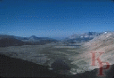
Much of the Sequoia backcountry (the entire eastern part of Sequoia)
is dominated by the North-South Kern Trench with
plateaus (and peaks) on either side. The Kern river flows south, but
ends up in Bakersfield (though in the summer it is dry before
it gets that far).
Access to the Kern is a long hike from the west
(Mineral King (7830ft), Crescent Meadow (6700ft)), or over
Forrester Pass (13,160ft) (Kings Canyon).
But mostly from the Inyo National Forest via the Mt. Whitney trail, or
Shepard Pass (12050ft, road: 4500) -- neither of these trails are easy
(perhaps the hardest part of the Whitney trail is getting a permit).
There is also a trail from the south along the Kern River.
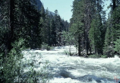 The Lower Kern River (6456ft at park boundary)
(even above where the Little Kern joins and it
gets even larger) is a real river. The bridge below the Hot Springs
was replaced after the spring melt shown here and is now well above the flow.
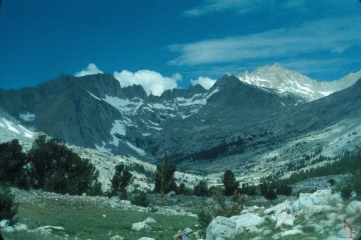
In its upper basin, the Kern is the
usual small Sierra creek as it flows out of Lake South America (a few
pictures later).
The Lower Kern River (6456ft at park boundary)
(even above where the Little Kern joins and it
gets even larger) is a real river. The bridge below the Hot Springs
was replaced after the spring melt shown here and is now well above the flow.
In its upper basin, the Kern is the
usual small Sierra creek as it flows out of Lake South America (a few
pictures later).
|
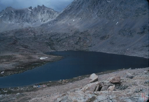
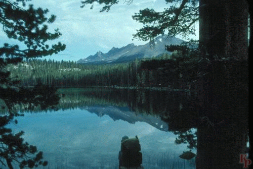 Moraine Lake (9290ft). Scenes like this are why people hike. The lake is on the
plateau above the Kern and below Kaweah Gap.
Moraine Lake (9290ft). Scenes like this are why people hike. The lake is on the
plateau above the Kern and below Kaweah Gap.
|
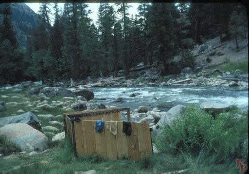 The Kern Hot Springs. The one hot bath in Sequoia. The tub drains directly
into the Kern River. It is a long way down
from the Muir Trail to the Hot Springs, so there is not a lot of
traffic.
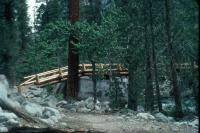
The bridge below the hot springs was washed out in 1980, but the new
one is much higher above the river.
The Kern Hot Springs. The one hot bath in Sequoia. The tub drains directly
into the Kern River. It is a long way down
from the Muir Trail to the Hot Springs, so there is not a lot of
traffic.
The bridge below the hot springs was washed out in 1980, but the new
one is much higher above the river.
|
 After crossing many side streams you get to the upper Kern canyon where
the raging (unfordable) Kern River turns into a small mountain stream.
Usually you can find enough water to camp if you can find an appropriate
place to camp.
After crossing many side streams you get to the upper Kern canyon where
the raging (unfordable) Kern River turns into a small mountain stream.
Usually you can find enough water to camp if you can find an appropriate
place to camp.
|
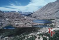
 Lake South America (11941ft). Think about the shape. Of course it is
the mirror view with Brazil on the Left. This is the upper lake on the Kern
River. This is also a lake where golden trout spawn.
Lake South America (11941ft). Think about the shape. Of course it is
the mirror view with Brazil on the Left. This is the upper lake on the Kern
River. This is also a lake where golden trout spawn.
|
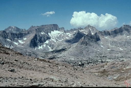 Above the Kern (along Tyndall Creek, 10900ft) you have the open views
typical of the High Sierra, with snow in August. This is the plateau
between the Kern canyon and the Sierra crest. Hiking is easy (this is
as flat as you get in the Sierra) with constant panoramic views.
The access via Shepard Pass (12050ft) meets the Muir Trail in this region.
Above the Kern (along Tyndall Creek, 10900ft) you have the open views
typical of the High Sierra, with snow in August. This is the plateau
between the Kern canyon and the Sierra crest. Hiking is easy (this is
as flat as you get in the Sierra) with constant panoramic views.
The access via Shepard Pass (12050ft) meets the Muir Trail in this region.
|
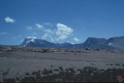 From The Bighorn Plateau, Whitney look like an easy trip.
That is Whitney in the left center of the image. The back side (the one
few people can really see) is almost flat for a while, but does have a cliff.
From The Bighorn Plateau, Whitney look like an easy trip.
That is Whitney in the left center of the image. The back side (the one
few people can really see) is almost flat for a while, but does have a cliff.
|
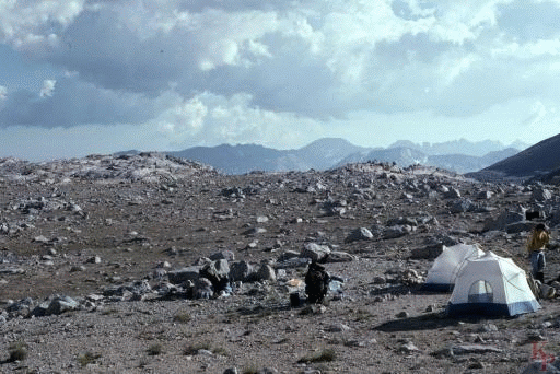 The Tyndall Creek region has ample (if rocky) camping, if you do not
need stakes. If you need them, you may be in trouble.
There is nothing like camping on rock. Camping on "a rock," especially one
6 feet high, is one of the pleasures of the Sierra,
it beats camping in pools of water. Later before the final climb,
Guitar Lake is a nice stop.
The Tyndall Creek region has ample (if rocky) camping, if you do not
need stakes. If you need them, you may be in trouble.
There is nothing like camping on rock. Camping on "a rock," especially one
6 feet high, is one of the pleasures of the Sierra,
it beats camping in pools of water. Later before the final climb,
Guitar Lake is a nice stop.
|
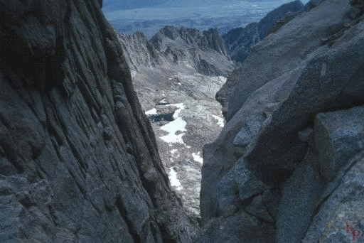 In places on the upper Whitney trail you can slip either direction.
Just stay on the trail. In high winds (and given the fact that
you are on a ridge near the highest peak for miles, high winds are the norm)
this is not always as easy as it sounds.
There are a number of dangers on this hike, altitude, loose rocks, ice,
lightening, and getting lost. This far out, other people or animals are
the least of your worries.
In places on the upper Whitney trail you can slip either direction.
Just stay on the trail. In high winds (and given the fact that
you are on a ridge near the highest peak for miles, high winds are the norm)
this is not always as easy as it sounds.
There are a number of dangers on this hike, altitude, loose rocks, ice,
lightening, and getting lost. This far out, other people or animals are
the least of your worries.
|
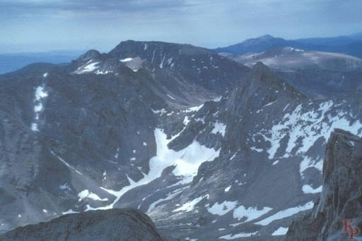 No picture captures the Whitney (14494ft, 4417m) experience. Some people do it
regularly -- it can be done as a day hike. For those who think the Whitney
day hike is too easy, try the Mt. Williamson (at 14375ft, 4380m,
the second highest peak in the Sierra, and the
peak that is most obvious from 395) day hike via Shepard Pass (stereo
of Mt. Williamson). The group we met at 6:00PM with (only) 6000'
more to go down were not so sure anymore. This is the view toward the
Whitney trail and Mt. Langley (14042ft, 4274m).
No picture captures the Whitney (14494ft, 4417m) experience. Some people do it
regularly -- it can be done as a day hike. For those who think the Whitney
day hike is too easy, try the Mt. Williamson (at 14375ft, 4380m,
the second highest peak in the Sierra, and the
peak that is most obvious from 395) day hike via Shepard Pass (stereo
of Mt. Williamson). The group we met at 6:00PM with (only) 6000'
more to go down were not so sure anymore. This is the view toward the
Whitney trail and Mt. Langley (14042ft, 4274m).
|
 Return to my Sequoia Kings Canyon home page.